


ScoutLook Hunting App
Weather & Property Lines

وصف لـScoutLook Hunting App: Weather & Property Lines
ScoutLook Hunting App Overview
ScoutLook Hunting is a free hunting weather app with an interactive GPS map. Hunters can use the app to get: pinpoint global weather forecasts, GPS property lines and landowner information, distance and area measurement tools, deer and other game logging tools, and much more! Save unlimited global hunting locations (treestands, blinds, trail cameras, etc.) to your free account.
Hunting Weather Forecasts
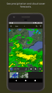
Hunting weather forecast details include temperature, cloud cover, precipitation, barometric pressure, wind activity, moon phase, and map overlays for radar and cloud cover. Hunters can also rely on sunrise and sunset times, plus peak game activity times.
New: Property Lines (Digital Plat Book)
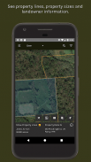
One of the best new features of the ScoutLook Hunting app is the Property Lines tool. This allows you to see property lines in all 50 states, covering 97 percent of the U.S. This includes landowner information: landowner name, property address, mailing address and property size are included in most listings. Unlike others, our hunting Property Lines tool is simple and quick to use with no delays.
Deer Hunting
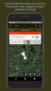
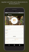
ScoutLook’s ScentCone® Wind Map shows where your scent will blow hour by hour, for 7 days, so you can precisely plan successful deer hunts. Save ideal wind conditions for each hunting location and ScentCone® will display a color-coded indicator to help you choose the best locations for given wind conditions. Choose the best hunt stand every time you go hunting! Log deer observations and sort logs according to weather conditions in your free online account. All these features also work great for hunting big game, predators and wild hogs.
Waterfowl Hunting
Our SetZone® Wind Map shows waterfowl hunters an hourly 7-day wind forecast to predict the best setups for duck and goose decoys. Log waterfowl observations in Waterfowl mode to track flight patterns and become a better waterfowl hunter.
Hunting Map Details
ScoutLook GPS hunting maps load quickly and accurately and offer the following layers: satellite map, topographic map and road map. Use your smartphone’s internal GPS to navigate, even without Internet connectivity. Offline map caching and viewing also works for ScoutLook’s Property Lines tool with landowner information.
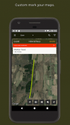
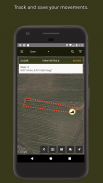
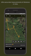
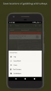
Save ScoutMarX to mark trails, parking areas, campsites, food plots, rubs, scrapes, scat, shed antlers, blood trails and more. Use our distance measurement tool like a laser rangefinder app, and use the area measurement tool for measuring hunting land or food plots. ScoutTreX allows you to track your movements in real-time and save them (blood trails, scouting, navigation, etc.).
Manage specific hunting properties by allowing hunters to view property details and contribute game activity logs with a secure property access code. Share saved locations with your hunting buddies.
ScoutLook Hunting is offered at no charge because of support from loyal advertisers with trustworthy products. You can upgrade to an ad-free version of the app for $9.99/year. The Property Lines tool can be purchased in the app for $5.99/month.
ScoutLook الصيد نظرة عامة على التطبيقات
ScoutLook الصيد هو حر التطبيق الصيد الطقس مع خريطة لتحديد المواقع التفاعلية. يمكن أن الصيادين استخدام التطبيق للحصول على: يحدد بدقة التوقعات العالمية الطقس، خطوط الملكية GPS والمعلومات مالك الأرض، وأدوات قياس المسافة والمساحة والغزلان وغيرها من أدوات لعبة قطع الأشجار، وأكثر من ذلك بكثير! حفظ المواقع غير محدود العالمية الصيد (treestands، والستائر، والكاميرات درب، الخ) لحساب مجانية.
صيد توقعات الطقس
وتشمل صيد الطقس تفاصيل توقعات درجات الحرارة والغطاء السحابي، وهطول الأمطار والضغط الجوي، نشاط الرياح، مرحلة القمر، وتراكب الخريطة للحصول على الرادار وسحابة الغطاء. يمكن أيضا الاعتماد على الصيادين شروق الشمس وغروبها مرات، بالإضافة إلى أوقات الذروة النشاط اللعبة.
جديد: الخطوط الملكية (الرقمية بلات كتاب)
واحدة من أفضل الميزات الجديدة من التطبيق ScoutLook الصيد هو أداة خطوط الملكية. هذا يسمح لك أن ترى خطوط الملكية في جميع الولايات ال 50، والتي تغطي 97 في المئة من الولايات المتحدة وهذا يتضمن معلومات المالك: اسم مالك الأرض، عنوان الممتلكات، وترد العنوان البريدي وحجم الممتلكات في معظم القوائم. وخلافا للآخرين، ونحن الصيد أداة خطوط الملكية بسيطة وسريعة لاستخدامها مع أي تأخير.
صيد الغزلان
يظهر ScentCone® الرياح خريطة ScoutLook حيث رائحة الخاص بك سوف تهب ساعة بساعة، لمدة 7 أيام، حتى تتمكن من التخطيط بدقة يطارد الغزلان ناجحة. حفظ ظروف الرياح مثالية لكل موقع الصيد، وسوف ScentCone® عرض مؤشر مرمزة لمساعدتك في اختيار أفضل المواقع لظروف الرياح معين. اختيار أفضل مطاردة يقف في كل مرة كنت أذهب للصيد! تسجيل الملاحظات الغزلان ونوع بتسجيل وفقا لأحوال الطقس في حساب بك على الانترنت مجانا. كل هذه الميزات أيضا العمل العظيم لعبة صيد كبير، الحيوانات المفترسة والخنازير البرية.
صيد البط
لدينا SetZone® الرياح خريطة تبين الصيادين المائية والرياح ساعة لمدة 7 أيام من المتوقع أن توقع أفضل الاجهزة عن البط والاوز الشراك الخداعية. تسجيل الملاحظات المائية في وضع المائية لتتبع أنماط الطيران وتصبح الطيور المائية صياد أفضل.
صيد تفاصيل خريطة
ScoutLook GPS حمولة الصيد الخرائط بسرعة وبدقة وتقديم الطبقات التالية: خريطة القمر الصناعي، خريطة طبوغرافية وخارطة الطريق. استخدام GPS داخلي الهاتف الذكي الخاص بك للتنقل، حتى من دون الاتصال بالإنترنت. حاليا خريطة التخزين المؤقت وعرض أيضا يعمل لأداة خطوط الملكية ScoutLook بمعلومات مالك الأرض.
حفظ ScoutMarX للاحتفال مسارات، أماكن وقوف السيارات، المعسكرات، المؤامرات الغذاء، والتدليك، والورطات، الموسيقي، إلقاء قرون، اثار دماء وأكثر من ذلك. نستخدم أداة قياس المسافة مثل التطبيق يأتي إطلاق الشركة ليزر، واستخدام أداة قياس مساحة لقياس صيد البر أو الغذاء المؤامرات. ScoutTreX يسمح لك لتتبع حركات الخاص بك في الوقت الحقيقي وحفظها (اثار دماء والكشفية، والملاحة، الخ).
إدارة الممتلكات الصيد محددة من خلال السماح للصيادين لمشاهدة تفاصيل الملكية والمساهمة سجلات نشاط اللعبة مع رمز وصول ملكية آمنة. حصة المواقع المحفوظة مع رفاقا الصيد الخاصة بك.
تقدم ScoutLook الصيد دون مقابل بسبب الدعم من المعلنين المخلصين مع منتجات جديرة بالثقة. يمكنك الترقية إلى إصدار إعلان خالية من التطبيق 9.99 $ / سنة. ويمكن شراء أداة خطوط الملكية في التطبيق 5.99 $ / شهر.


